Virgin Islands Info
SUP Dream Destination: Virgin Islands
Are you looking for a totally awesome place to paddle? How about the Virgin Islands? They are a stunningly beautiful collection of about 70 islands, inlets and Cays in the Caribbean that are incredibly close together. They were an El Dorado for pirates in former times, with their hidden and unaccounted bays, perfect to hide and wait for the Spanish Ships that were loaded to the brim with gold from the new world.
Today, they are paddler’s paradise offering everything from calm bays for beginners to crossings and crazy downwinders for experienced paddlers and if you are lucky you might find some really good uncrowded waves, too!
Where are they?
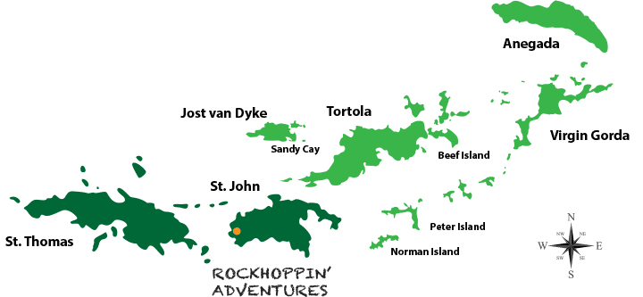
The Virgin Islands are the western island group of the Leeward Islands, which are the northern part of the Lesser Antilles, and form the border between the Caribbean Sea and the Atlantic Ocean. They are located about 80 km east of Puerto Rico, which is 1500km South East of Florida. Christopher Columbus named the islands after Saint Ursula and the 11,000 Virgins (Spanish: Santa Ursula y las Once Mil Vírgenes), shortened to the Virgins,
Politically, the eastern islands form the British Virgin Islands (Tortola, Jost van Dyke, Virgin Gorda, Anegada) and the western ones form the Virgin Islands of the United States (St. Thomas, St. John, St. Croix). That’s actually the only annoying part, when paddling / island hopping, you need to take your passport checking in and out between US and UK Customs & Border Protection. The currency is US$ and Motor vehicles are driven on the left-hand side of the road in both the British and the U.S. Virgin Islands, although the steering wheels on most cars are located on the left side (as is the norm for drive-on-the-right localities).
Island Overview
